Pithoragarh to celebrate its’ 66th raising day with hopes, aspirations
Pithoragarh to celebrate its’ 66th raising day with hopes, aspirations
B.D. Kasniyal
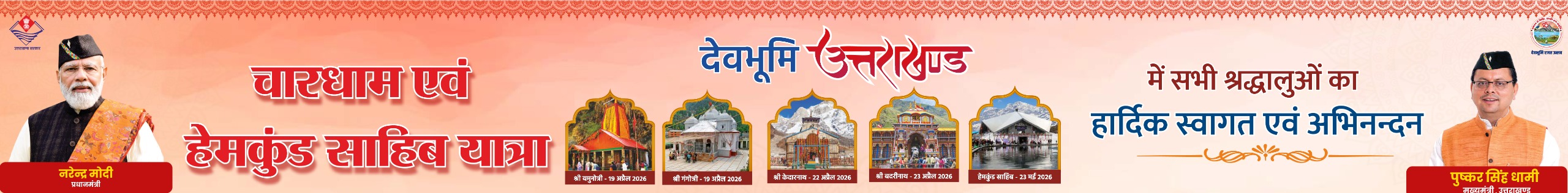
Pithoragarh, Feb 9
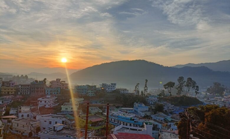
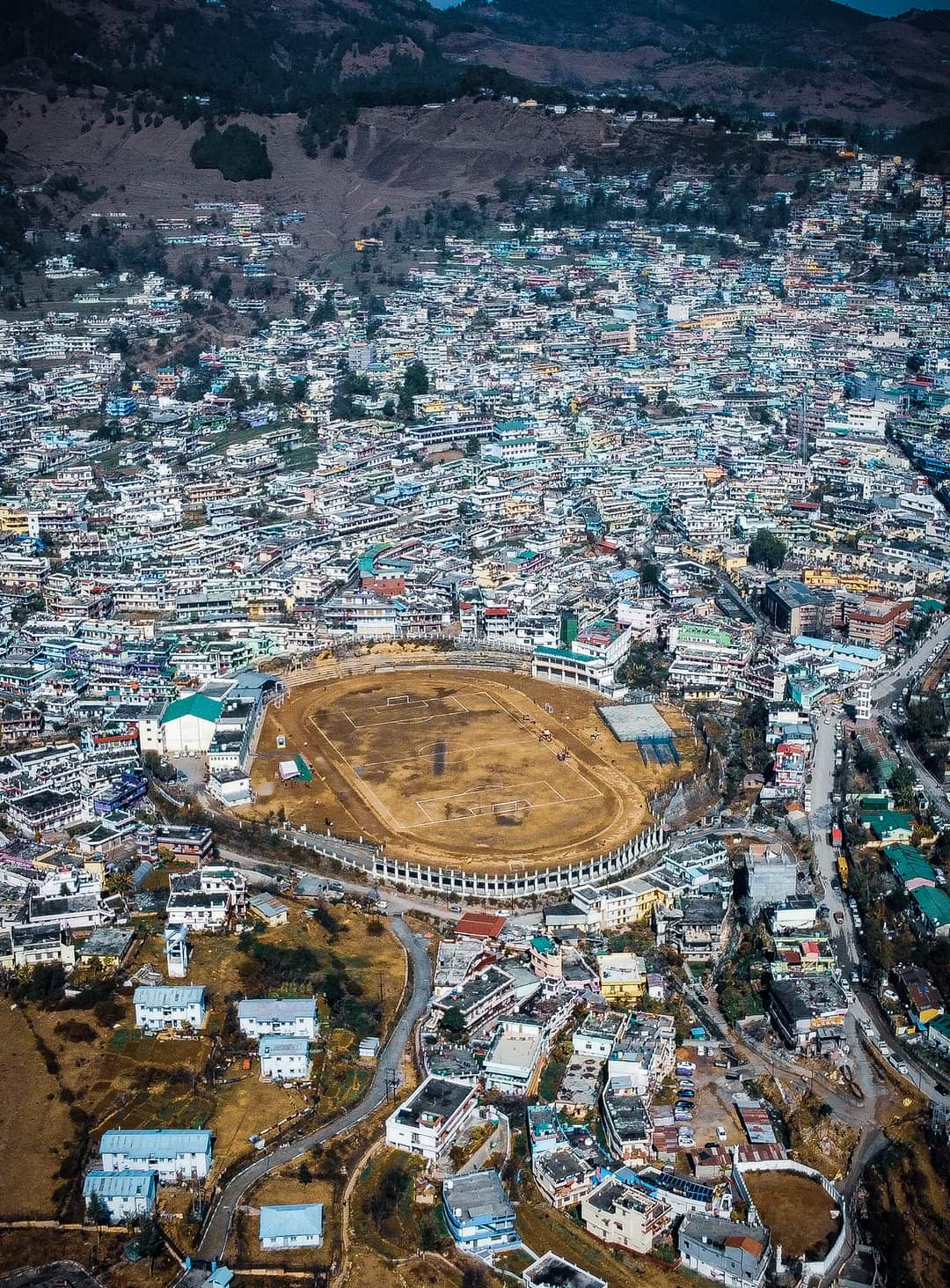
Pithoragarh, a border district of Uttarakhand state that was named after the district headquarter town in 1960, when the sub division of Almora of same name was given district status with two other districts of Uttarakashi and Chamoli, purely for defence needs of northern borders of the country. Pithoragarh district will be celebrating its’ 66th raising day on February 24, 2026.
If taken history of settlement in Pithoragarh district area, it has been proved from ancient time, after the discovery of a pre-historic cave and painting inside it, in Berinag region of the district, a year ago.
“Some more cave settlements have also been found in the district, which are under the process of historical verification, “said Chandra Singh Chauhan, Regional Archaeological Officer of Kumaon region based in Almora.
According to Chauhan, Pithoragarh has undiscovered evidences of not only from pre-historic era but also of historical from Kunind era to Katyuri, Chand, Gurkha and British era, claimed Chauhan.
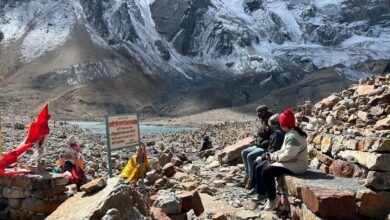
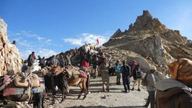
“If studied from Puranic angle, whereas Soor, Gangolihat, Seera, Askot, Chaudans and Vyans regions were the routes to sacred ‘Kailash Mansarowar’ pilgrimage, the Soor valley region was pathway to pilgrims from across the nation to Muktinath dham, situated in Nepal,” said Chauhan quoting historical writings of late Dr Ram Singh.
” The headquarter town that gave the district it’s Identity, was known as Soor pargana during British era after 1815 and Soor, before even that. “Though the name Soor seems to have driven after a lake(sarowar) in valley region, as according to Dr KS, Waldia, a world fame geologist of Himalayan region, the valley was full of water bodies from 4000 years that was under process of receding which remained till 1500 years ago. It was only after that the settlements started in the Soor valley,” said Dhirendra Joshi, a geologist based in Pithoragarh.
The name, Pithoragarh prevailed after Gurkha advent of the valley in 1790, when the new rulers started constructing a fort at a hill of Pitrota village, situated on the western ridge of the headquarter town, and that fort was named as Pitrotagarh, later known as Pithoragarh,” said Padma Datt Pant, whose works towards finding source of the name Pithoragarh, was logically appreciated by scholars.
Some scholars also consider that the name Pithoragarh was taken from the fort constructed here by Rai Pithora, a ruler of the 14th century or from Piru Gusain, an employee of Chand kings in 17th century
Pithoragarh is beautiful and serene place and geographically lies in the lap of surrounding peaks of Chandak hill, Hyupani range, Sorlek hill and Thalkedar mountains. These hill ranges are traditional source of not only water but fodder and fuel wood for residents of Soor valley.” These surrounding forest ranges ( from 5000 to 8100 feet), also used to feed by providing fodder to animals of over 100 villages around the Soor valley and also fuelwood to the households before modern means of fuel and fodder reached the valley,” said Trilok Singh, a senior resident of Jakhni village.
Pithoragarh does not only represents Soor region but also culturally rich regions of Sira, Askot, Gangawali, and tribal regions of Chaudans, Vyans, Darma and Johar regions. “These administrative parts of the district, not only mere administrative blocks but also having a separate cultural and linguistic identity within the district. “Besides that a distinct tribal group, named as ‘Ban Rawats’, represents puranic ‘Kirat’ ethnicity in its present form lives in the district making the district more colourful culturally,” said Hemraj Singh Bisht, director of Navodaya Kala Kendra, a cultural troupe active in the district.
After the formation of the district in 1960, the central or the then UP governments paid attention to its’ connectivity since it was on Indo-China border by constructing roads to border regions though other infrastructure still lacked.
“The migration from border villages, started after 1962 Indo-China war, is being addressed after more than 60 years today besides infra needs of border are still to be taken care,” said Shalu Datal, a journalist based in Dharchula.
“We have complete basic infrastructure of roads, drinking water, electricity, education, communication and health in district but developmental needs rise from time to time and are being addressed by micro planning at the district level,” said Deepak Saini, Chief Development Officer of Pithoragarh district.
But the district faces the common ill of the hill state of large-scale migration from hill villages. According to Uttarakhand migration commission data, over 31000 persons from nearly 589 villages of the district have left their original habitat in the last 10 years only “The migration, caused by non-availability of basic facilities and livelihood opportunities in villages of the district, is towards district and sometimes sub- divisional headquarters, besides to other cities of state and country, as the concentration of basic facilities like education health and employment has been concentrated in the larger cities. The people in hills also face the problem of wild animals, geographical marginalisation, lack of education and health facilities. Had there been decentralised basic facilities, planned by state or union governments, the migration would have been least checked, “said Kashi Singh Airi, a seniormost leader of Uttarakhand Kranti Dal (UKD), a regional political party and a senior leader of statehood movement.